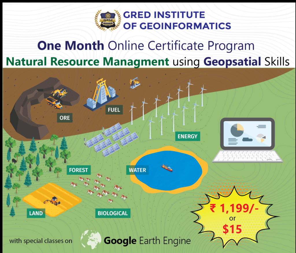
Empower Your Career in Natural Resource Management with Geospatial Skills Unleash the Power of Spatial Data to Make a Difference
Are you passionate about protecting our planet’s precious natural resources? Do you want to use cutting-edge technology to make a real impact in the field of environmental conservation? Then our one-month Natural Resource Management using Geospatial Skills program is for you!
In this intensive program, you will:
Gain a comprehensive understanding of Geographic Information Systems (GIS) and Remote Sensing (RS) technologies. Learn how to apply these powerful tools to real-world natural resource management challenges, such as:
- Forestry and land-use planning
- Biodiversity conservation and habitat mapping
- Water resource management and drought monitoring
- Disaster preparedness and response
Why choose this program?
Build a strong career profile: Geospatial skills are in high demand across a variety of industries, including environmental consulting, government agencies, non-profit organizations, and private companies. This program will give you the edge you need to stand out from the competition and land your dream job.
Make a real difference: By applying your geospatial skills to solve critical environmental challenges, you can make a lasting positive impact on the planet.
Gain practical experience: Our program features a strong emphasis on hands-on learning, so you’ll graduate with the skills and confidence to hit the ground running in your new career.
Join a supportive community of like-minded individuals
Enroll today and start your journey towards a rewarding career in natural resource management!
** Above mentioned modules are subject to change at any moment of the course, depending on the trend of the current GIS market and some other external factors.